Wednesday, January 19, 2011

Geology on 35mm film #2 - Soft sediment deformation


©RomaniaRocks
Soft sediment deformation in the form of a small compressional fold, in the
Olanesti Formation (Eocene). Note the undeformed strata above and below
the fold.  The outcrop is located in a road cut, east of the Olt river.

Good examples of soft sediment deformation structures exist in the Eocene section of the Getic Basin in Romania.  The photographs give some examples of reverse faults and small compressional folds found in road-cut outcrops to the east of the Olt River.

These features most likely formed in a pro-delta environment, characterized by high sedimentation rates and relatively steep slopes.  Because of the high sedimentation rates, water did not expel easily from the recently deposited sediment.  This resulted in increased pore pressure immediately after deposition, which lead to displacement and movement of unconsolidated sediment.

©RomaniaRocks
Soft sediment deformation in the form of a small compressional fold.
The strata are Eocene in age and the outcrop is located east of the Olt river.
©RomaniaRocks
Soft sediment deformation in the Eocene strata, Getic Basin.
The section consists of silty mudstone with interbeds of sandstone.
The deformation is in the form of a reverse fault.

Sunday, January 9, 2011

Mud cracks revisited

In a previous post I showed a picture of the desiccation cracks that formed when a little pond on our Brenham property dried out this summer.  We visited three months later (yesterday), and found that the cracks in the mud weathered, and now look more like ant mounds.  The two pictures, side by side are shown below.
October 14, 2010                ©RomaniaRocks                          January 8, 2011
Three-month repeat photography of desiccation cracks, Brenham - Texas.
The picture to the left was taken immediately after the water in the pond evaporated; the mud on the bottom of the pond was exposed to the surface, it shrunk and cracked resulting in the polygonal shapes shown in the photo.  As the mud continued to dry during the three months of subaerial exposure, it lost its strength and started to crumble, taking the mounded form shown in the picture to the right.

Also very interesting is the fact that this polygonal pattern so characteristic to the desiccation cracks shows up in many places and at a variety of scales in nature, from beer foam, to the skin of a giraffe, to structures found at the nano-particle scales, to patterns found in the Universe.  The short video below  from University of Nottingham-Sixty Symbols describes very nicely the multi-scale occurrence of the polygonal pattern.

Saturday, January 1, 2011

The Danube, New Year, Vienna and Music

Odd combination one may say, but there is a common thread here.  On January 1st every year I watch the New Year's concert from Vienna; it is a family tradition, about which I blogged here one year ago.  The concert is centered around music from the Strauss family, and one of the most anticipated pieces every year is the Blue Danube waltz.  So there, you now see the connection.

The Danube River ends its "journey" in the Black Sea, where it forms the Danube Delta, which is one of my favorite places in Romania for many reasons: scenery, geology, landscape, people, the food, the culture, and the list could go on.

The Danube Delta (Romania and Ukraine). Image credit - Chelys, via Earth Snapshot.
The Danube Delta overlies two geologic provinces: the Scythian Platform and the Pre-Doborogea Depression.  The deltaic sedimentary complex is up to 400m thick and formed during Late Pleistocene - Holocene. The delta consists of three depositional systems: 1) a deltaic plain, which in the picture above is roughly the dark green area, from the first point of bifurcation of the Danube River (marked by the red circle in the photo above), to the shoreline; 2) the delta front parallels the coast and roughly coincides with the area where sediment plumes are visible in the water; and 3) the pro-delta, offshore of the delta-front, in water depths as deep as 50-60m.

In Vienna, on every January 1st, the Blue Danube waltz is the second of the three encore pieces played during the New Year's Concert.  The tradition is that the orchestra starts the music, and after the first few measures the audience interrupts with applause.  The conductor stops the music, turns towards the audience and wishes everyone a Happy New Year, after which the orchestra resumes the music.

I wish everyone a happy, healthy and prosperous 2011, and I am looking forward to some Champagne and waltz music tonight, including one of my favorites - the Blue Danube Waltz.

Happy New Year!

Wednesday, December 29, 2010

Romania viewed from above - Carpathians and the Black Sea

Envisat image showing the deep freeze that affected the southeastern Europe in January 2010.
Image source - European Space Agency

Weather in Europe has been very rough recently, so it looks like the year will end the same as it started: cold!  The picture above is from January 25, 2010 and it shows the deep freeze in SE Europe at the time.  The Carpathians are visible in the center left, the Danube Delta is seen in the center of the image, at the edge of the Black Sea.

Sunday, December 26, 2010

Geology on 35mm film - Conglomerates

I started going through my old 35mm slide collection representing geological field work from the pre-digital era.  Some of these places I will probably not visit again, at least not anytime soon, so I am bringing them to life with the help of a digital scanner.

The Paleocene rocks in the Southern Carpathians foredeep are represented by poorly sorted, massive, clast-supported conglomerates, which onlap  the crystalline basement.  They consist of angular fragments of schist up to 1m in diameter, as shown in the photo below.

©RomaniaRocks
Calimanesti Conglomerate on Topolog Valley, Southern Carpathians - Romania
The schist fragments are lithologically similar to metamorphic rocks in the Southern Carpathians.  The massive conglomerates grade upward into upward-fining cycles of conglomerate and sandstone, each cycle about 8m thick.


©RomaniaRocks
Upward-fining cycles of conglomerate and sandstone.
Calimanesti Conglomerate, Valsan Valley-Romania.
The upward-fining cycles have a clear erosional base, and the lithology of the clasts are more diverse, consisting not only of crystalline rocks, like lower in the section, but also of sandstone and limestone.
©RomaniaRocks
Calimanesti Conglomearte, Valsan Valley - Romania.
Note the erosional base and fining-upward character.
The sandstone at the upper part of each cycle is medium- to very coarse grained and massive, flat-beddd or cross-laminated.
©RomaniaRocks
Calimanesti Conglomerate, Valsan Valley-Romania. Note the erosional base,  
large fragments of crystalline rocks and the finning-upward character
The conglomerates described above were deposited by overlapping alluvial fans sourced by the Southern Carpathians.  The poorly sorted, angular, coarse textured deposits, with fragments up to one meter in diameter are indicative of debris flow deposits, a common occurrence in alluvial fans.  The Paleocene landscape of Romania was probably not too different than the landscape in the photo below, from the Rocky Mountain National Park in Colorado.
©RomaniaRocks
Alluvial fan at the mouth of a canyon in Rocky Mountain National Park, Colorado.
A hike on top of the fan in the Rockies reveals the size and complexity of the fan.  I bet a hike in the Paleocene in Romania, on top of the Calimanesti Conglomerate would have been somewhat similar, less the ability to use the humans for scale :)
©RomaniaRocks
Close-up view of the alluvial fan in Rocky Mountain Park, Colorado.

Friday, December 10, 2010

Earth as art #1

Photo credit - European Space Agency
Fascinating geomorphology in the Arctic tundra combined with modern technology (multitemporal Advanced Synthetic Aperture Radar), gives this amazing image that rivals the most creative human talent.
Enhanced by Zemanta

Sunday, December 5, 2010

Rivers, geology and culture (#1) - Arges, Romania

A river represents the perfect fusion between geology and culture.  Rivers  are characterizesd, generally speaking, both by erosion and deposition; this is where the geology aspect comes from.  Think of the Grand Canyon and you can visualize the results of river erosion through time.  Take a canoe down or up a river, stop on the river bank for lunch and look around; the canoe trip and the lunch break will help you witness river processes, deposition and their resulting features.
Rivers are also amazing "cultural centers", in the sense that human settlements usually started along a river.  Any major city in Europe for example is  associated with a river: Paris-Seine, Vienna-Danube, Frankfurt-Main, Bucharest-Dambovita, Rome-Tiber, and the list could go on...  This is where the cultural aspect comes from.
With this post, I am starting a geological-cultural trip along a river, the Arges River in Romania, to be more precise; I imagine I am a rock particle (or a water molecule) originating from the Southern Carpathians and traveling along the Arges River all the way to the Danube.  The trip will witness some amazing history (geological and human), culture and landscapes.
The Arges River headwaters are located in the Southern Carpathians, between the two highest mountain peaks in Romania: Moldoveanu and Negoiu.
Google map showing the headwaters of the Arges River, located between Negoiu and Modoveanu, the highest mountain peaks in Romania.  Top of the map is towards South.
Geologic sketch of the area around
the Arges River (modified after  Mutihac, 1990). Note that only
the geology relevant to the Arges River is represented in color.
Cn2= Serbota crystalline series; Cn1=Fagaras crystalline series;
Pg=Paleogene; m=Miocene; N=Neogene
The Arges River has its headwaters in the metamorphic rocks of the Fagaras Mountains.  The views are breathtaking, the weather is harsh and as a result, the few motels and chalets that exist in the area function only during the summer.
The upstream part of the Arges River is probably most famous because it parallels the second highest paved road in Romania - the Transfagarasan. The road was built in early 1970's in response to the Soviet invasion of Czechoslovakia. Ceausescu, the Communist President of Romania at the time, wanted to have quick access across the mountains in case the Soviets attempted a similar move in Romania.  The road was built with heavy human (forty people lost their life) and financial sacrifice.
The next posts will take us to the Vidraru lake, then through the most upstream permanent settlements (villages) along the river; this will allow us to explore more geology and culture.

Saturday, December 4, 2010

Romania viewed from above - Bucharest

Synthetic Aperture Radar (SAR) multitemporal colour composite image of south-central Romania with focus on Bucharest. Photo Credit - European Space Agency
Bucharest (Bucuresti in Romanian) is the bright area in the center right.  The city lies on the banks of the Dambovita River, and its name comes from Bucur who, depending what legend you take into account, was either a prince, an outlaw, a shepherd or a hunter.
More on Bucharest from the local administration website and the Wiki site. More on Synthetic Aperture Radar here.

Tuesday, November 30, 2010

Happy Birthday Romania!

On December 1st Romanians everywhere celebrate the National Day of Romania. To do my part, I put together some of the photos from my trip to Romania this summer. The pictures are from Bucharest, Zarnesti, Piatra Craiului Mountains, Brasov, Bran, Rucar-Bran. The music is composed by Ciprian Porumbescu. This is for "My Romania", with love, and for all of you to enjoy!
PS sorry for the less-than-perfect image quality. Blogger did not let me upload the hi-rez version :(

Thursday, November 25, 2010

Romanian National Parks

On my to-do list in Romania is to hike all of the National Parks.  As a note to self, and also to entice others to go and visit these beautiful places, this post provides a map and links to some of the parks.  One of the best things about National Parks, in Romania or elsewhere, is the geology associated with the breathtaking views. This post is about some cool places in Romania where you can see awesome geology and experience great landscapes, views and culture.

View Romanian National Parks in a larger map
Apuseni Nature Park (Rom. Parcul Natural Apuseni): best known for the beautiful karst landscape and its numerous caves.
Bicaz Gorge - Hasmas National Park (Rom. Parcul National Cheile Bicazului-Hasmas): best known for the spectacular Bicaz Gorge
Calimani National Park (link in Romanian) (Rom. Parcul National Calimani): located in the Calimani volcanic chain.
Ceahlau National Park (link in Romanian)(Rom. Parcul National Ceahlau): Ceahlau Mountain is also called the Olympus of Romania, because of its significance in the history of the Dacians, the ancestors of the Romanian people.  Ceahlau was considered to be the sacred mountain of Zalmoxis, the ancient deity of the Dacians.
Piatra Craiului National Park (Rom. Parcul National Piatra Craiului): one of my favorite places to hike. Beautiful Mesozoic limestone landscape.
Retezat National Park (link in Romanian)(Rom. Parcul National Retezat): best known for the beautiful landscape sculpted by long gone glaciers, it is the park in Romania with the highest number of mountain peaks over 2000m in height.

Wednesday, November 24, 2010

Your path looks boring? Explore the edges!

Everyone's research (or career) path looks like this at one point in time or another.
Whether looking ahead ...

... or in the rearview mirror....
... the path may look flat, predictable, and downright boring. When that happens, there are three choices: continue ahead and hope some exciting breakthrough is waiting around the corner (good luck with that!); change course to a more exciting destination (take the train if needed, to get there faster); or go off the beaten path and explore the edges of your own discipline, and in the process listen to the echoes coming from fields outside your own.  It is the latter that has the potential to bring the biggest breakthroughs.
Happy trails, and remember: it is the journey that counts.

Tuesday, November 23, 2010

Geology field notes - Process to product: ripples

One nice thing about beaches is that you can observe processes and the resulting products  at the same location.  The video clip and the picture were taken from a beach not far away from my home (ok, about an hour drive...).
In the short movie below, the wave action on the beach creates a water flow that entrains the sand and generates moving bed-forms (ripples) on the bed surface.

The resulting rippled bed surface looks like this.
Ripples on a beach                                 ©RomaniaRocks
If the process continues and net sediment accumulation takes place, the result is a ripple-laminated sand.
Enjoy your next walk on the beach and take your own pictures and video-clips of ripples in the making.

Sunday, November 21, 2010

Speleology in Romania - Frasin Aven

Speleology is what got me into geosciences in the first place, therefore a series of posts on caves of all sorts in Romania is in order.
An aven in caving is a very steep or vertical section in a cave that needs ladders or ropes to ascend  and descend. The Frasin Aven (link in Romanian) is located in the Obcina Mare Mountains, which are part of the Eastern Carpathians mountain range.

The Frasin Aven is the northern-most pin on this map; zoom out for better viewing.  Locations of other caves in Romania are also indicated on the map.
View Romanian caves in a larger map


The Frasin Aven can be accessed from Frasin village, on the National Highway #71, between Gura Humorului and Campulung Moldovenesc. The aven was discovered in 1975, it has an elevation change of 73.2 meters, which placed it in the 20th place in the world for elevation change for sandstone caves (based on 1989 statistics).
Frasin Aven sketch, after Giurgiu and Muraru, 1977
From a geologic point of view, the aven is located in the Carpathian Fold and Thrust Belt (Tarcau Nappe), and it is developed in Kliwa Sandstone Formation (Oligocene in age). Kliwa is a deep-water siliceous sandstone (98% silica content), and the aven is thought to have formed within a fracture caused either by extension associated with its position on a crest of an anticline, or via detachment and sliding of the sandstone block along its basal contact (the Kliwa Formation consists of a succession of interbedded sandstone and mudstone).

Wednesday, November 17, 2010

Seismic geomorphology research conference


If you are in or near Houston-Texas, or can get to Houston in early December, I highly recommend this: the 30th Annual GCSSEPM Foundation Bob F. Perkins Research Conference - "Seismic imaging of depositional and geomorphic systems".  With a 3-day full program, the BEG visualization center set up for people to view data volumes, and keynote speakers such as Kurt Marfurt, Sergey Fomel, Henry Posamentier, this will be THE conference on this topic for years to come.
The conference will be held at the Houston Marriott Westchase,  on December 5-8, 2010.  You may register for the event here.
The conference will cover the entire spectrum of depositional systems, clastics and carbonates, a wide variety of geographical locations, basins and geological settings: incised valleys on the Sunda Shelf, Indonesia; carbonate platform systems in the Browse Basin, Australia; estuarine deposits in the Gulf of Cambay, India; Pleistocene turbidites from NE Nigeria; point-bars in the McMurray Formation, Canada; channel-levee complexes, slope valleys and canyons from East Kalimantan, Indonesia; and much more.
I will be sharing on Twitter and blogging from the conference (hopefully).

Sunday, November 7, 2010

Fluvial and aeolian rocks from the Triassic of Utah

Rocks are like people...in some ways. You take the same "material" (be it genetic for people, sedimentary for rocks) and place it in different environments, and you will get different results.
©RomaniaRocks
One of the principal goals in sedimentary geology is to identify the environment of deposition by looking at rocks and their characteristics.  It is very important to be able to determine if a package of rocks was formed by wave processes pounding on a beach, by river processes, or by gravity flows traveling from submarine canyons to the abyssal plain of oceans.  It is important because by doing so, we can understand, for example, past climate (and use it to predict future climate), we can understand the Earth complex systems, we are able to make predictions about the presence (or absence) at a certain location of a certain rock type, etc.
This post shows an example  of the difference between fluvial and eolian rocks.  Both pictures (above and below) show the eolian Wingate Sandstone, overlying the fluvial Chinle Formation.
©RomaniaRocks
The Wingate Sandstone forms the steep, upper pat of the cliff. It is called an aeolian sandstone because it was deposited by the action of the wind in a desert environment, not unlike what the Sahara desert is today.  
The Chinle Formation can be seen immediately below the Windgate, it is more heterogeneous from the point of view of the lithology, consisting of mudstone, sandstone and conglomerate.  The Chinle was deposited by rivers flowing on a floodplain.

Immediately after hitting the "Publish post " button I saw "Where does desert sand come from?" talking about the Namib Sand Sea, and posted on the AGU blogosphere site by Vivienne.  An appropriate present day analogy for the Wingate of the Triassic.

Enhanced by Zemanta

Monday, November 1, 2010

Geology field notes - Mud cracks

©RomaniaRocks

When muddy sediment is exposed to the atmosphere and dries up it commonly develops polygonal shape cracks in plan view, V-shaped in cross section.

Monday, October 4, 2010

Landscapes into Rock - Part 4

This post ends my summary of the Landscapes into Rock conference that took place in London, September 21-23, 2010.  Click here for previous posts.

Theme three – Landscapes into Rock – was obviously the central theme of the Conference. It was chaired by Sebastien Castelltort (ETH – Zurich) and Emma Finch (University of Manchester), it had eleven oral presentations and featured a very insightful “keynote of the keynotes” by Mike Leeder (University of East Anglia). Of interest for me was the research by Alex Whittaker et al using regional grain-size trends to derive information on the dynamics of the sediment routing system.

The high-point of the session was the keynote address by Mike Leeder. Mike put forth many interesting and provocative ideas:

  • the need to fully utilize the sedimentary record to test the landscape evolution models; 
  • the recent advances in speleothem and calcisol research that may provide the ability to isolate climate/vegetation forcing of the eroding landscape; 
  • the understanding of the link between the rate of tectonic evolution and how they induce major changes in the landscape; 
  • teleconection – the link between the eroding landscape and the downslope deposcape.

The fourth (and last) theme – Integrative studies of sediment routing systems and the petroleum systems - was organized by Ian Lunt (Statoil) and Mike Blum (ExxonMobil), and featured two presentation and two keynote speakers – Ole Martinsen (Statoil) and Peter Burgess (Shell and Royal Holloway University of London). For me, the highlight of this session was Peter’s overview of stratigraphic forward modeling in hydrocarbon exploration. Peter noted that stratigraphic forward models (SFM) are more mature but still have a limited predictive power. SFM prove most useful in their ability to quickly create multiple scenarios, to test hypotheses and ideas, to devise numerical experiments that illustrate how depositional systems work and through that to develop new plays and concepts.

On a less-formal side, the conference ended each day with a social hour, which involved a lot of discussion of the ideas presented during the day, accompanied by wine, of course.  The discussions were less formal, but certainly not less technical.  They were less flashy than the gathering that took place at Dolce & Gabbana one evening, just down the street from the Burlington House (picture below), but the social hour at the Landscapes into Rock conference were certainly more intellectually stimulating -- for me :)

Sunday, October 3, 2010

A day on the river

You are a geologist when you have fun digging trenches to see cross-bedding and when you enjoy photographing mud clasts on a Saturday afternoon.
©RomaniaRocks

I am a geologist, so is my SO, and this weekend we enjoyed a trip along the Trinity River; beautiful weather was a plus, and it made it for a great family outing.  We started with our canoe from the bridge across Trinity near Liberty, TX.  From here we went north for about 7 km in total (the red line shows our path for the day).
The first stop was on the opposite bank from the meander loop cut-off, indicated by the yellow arrow in the picture above.  A point bar with a lot of awesome features, worthy of any Geology 101 class: ripples and dunes...
©RomaniaRocks
... with awesome lineation in the coarse grain fraction oriented parallel to the transport direction (downstream is towards the top of the picture).
More ripples and dunes...
©RomaniaRocks
... mud cracks and the resulting mud-chips waiting for the next bank-full discharge to be washed away....
©RomaniaRocks
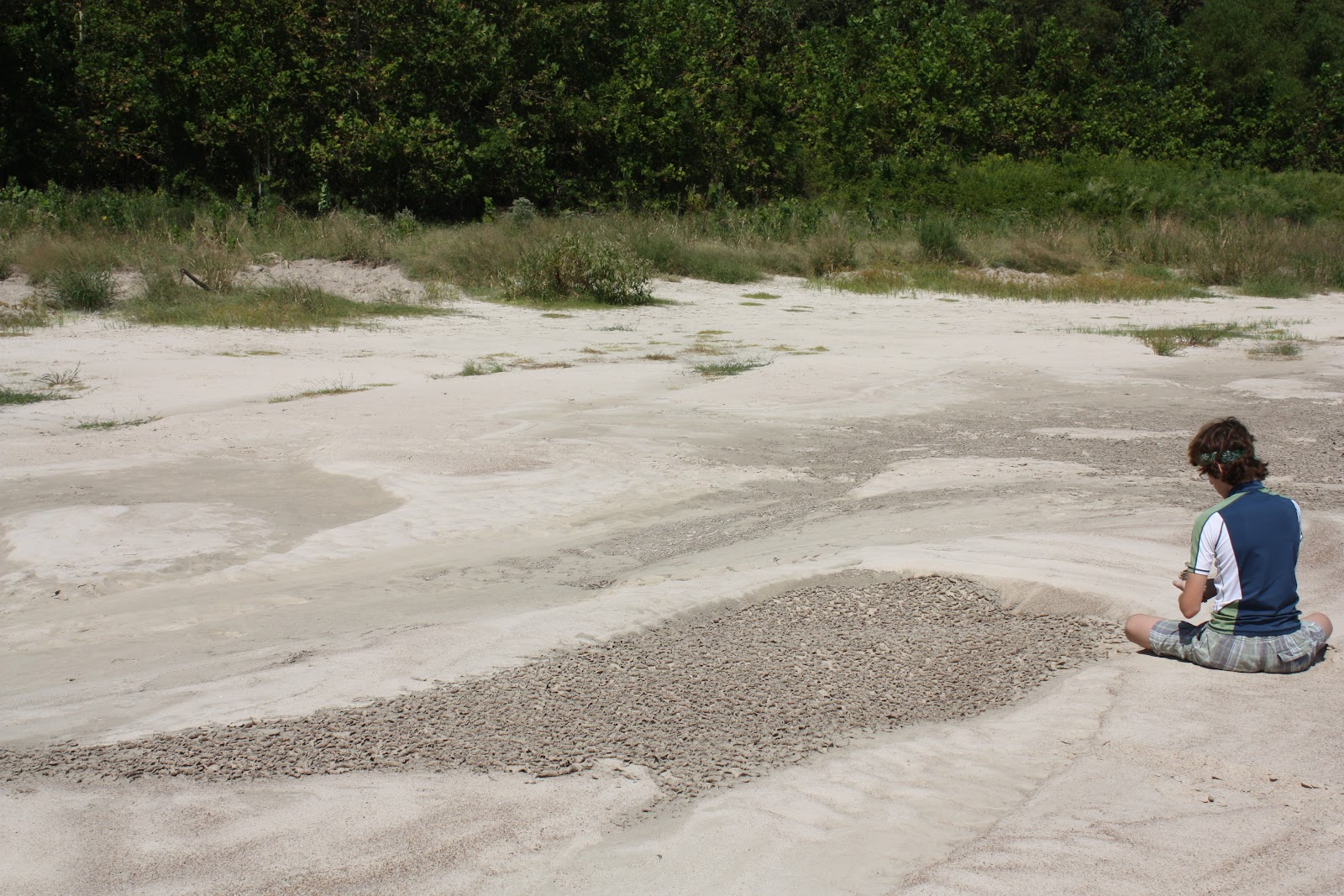
... unless of course your teenager will not remove them all by building mud-chip castles.
©RomaniaRocks

The mud cracks on the surface of this point bar developed in low areas, when water level was just above the edge of the depression where the mud accumulated.  Eddies formed in these low areas of the point bar, and these eddies brought in and deposited a thin layer of mud.  The mud cracks formed later after the water receded and the surface dried out.  Similar eddies carrying and depositing fine-grained material (but at a larger scale) were responsible for the deposition of a nice mud-drape on one of the point bars we stopped at further upstream.  The picture below shows the river bank with the water flow from right to left, and a protected area entered by an eddie, which deposited a beautiful mud-drape over the extent of the point bar exposure (arrows indicate the extent of the mud drape).
©RomaniaRocks

Well developed cross-bedding may be seen within the point bar succession....
©RomaniaRocks
... and ripple lamination, cross-bedding and wind ripples may be found in the right exposures on the point bars...
©RomaniaRocks
We had a blast: great weather, nice river, good canoeing, and cool sedimentary features.  You get the picture :)
Enhanced by Zemanta

Comparative geology - the tale of two rivers

I recently went on a canoe trip along the Trinity River (our track is shown by the red snaky line in the picture below).  We spent the day looking at sedimentary features associated with modern river systems, and by doing so, thinking about processes at work in rivers, and the resulting rock architecture.  As geologists, we often study modern environments (like rivers, beaches, deltas etc) to gather clues that help us understand the rocks and the processes that formed them.
The trip to the Trinity (more details in this post) reminded me of the Arges River in Romania; if looked from above, both have a lot in common.
Note that the scale of the two satellite images are similar, so the size of the geomorphic features can be easily compared.  The width of the meander belt in the two images is similar.  Two abandoned meander loops (red arrows) have similar dimensions and shape.  Their paleo meander belts (active sometime in the recent past and still visible on the satellite image) have similar widths (black arrows).
The zoomed satellite photos show that the size of the active channels are similar.  The Arges shows better the point bars within the active channel, but this is only because the picture of the Trinity was taken at near bank-full stage, where most of the point-bars are submerged.
These two rivers, although in somewhat different settings, would most likely create a very similar rock succession.  I have to take a canoe trip along Arges sometime in the future, and at that point I will have on the ground pictures from the both locations.  Until then, wait for the next post on the Trinity, and enjoy the birds-eye view of the two rivers.

Monday, September 27, 2010

Landscapes into Rock - Part 3

This post continues my summary of the Landscapes into Rock conference that took place in London, September 21-23, 2010.  Click here for previous posts.

The second theme of the conference – The Dynamics of the Sediment Routing System – was chaired by Alex Densmore (Durham University) and Ruth Robinson (University of St. Andrews), who assembled a very good mix of nine talks and three keynote speakers: James Syvitski (University of Colorado), Greg Tucker (University of Colorado) and Chris Paola (University of Minesota).

Interesting research of the Golo source-to-sink system was presented by Tor Somme (University of Bergen) et al.  One of the interesting conclusions was that channel aggradation may occur both during eustatic highstand and lowstand, and that sediment partitioning along the source to sink continuum may be controlled by internal thresholds rather than external forcing.

 The keynote by Greg Tucker (University of Colorado) on rapidly changing landscapes underscored some interesting points:

  • channel incision rate correlates with characteristic stream power and shear stress;
  • temporal variability in sediment cover is an important control in long-term bedrock river incision.

Chris Paola’s keynote address on mass balance effects in depositional systems was full of insight, discussing many fascinating concepts:

  • fractional sediment extraction and the subsidence-driven depositional mass loss 
  • similarity in fining profiles along depositional trends
  • the use of generalized models/experiments as reference cases of down transport changes, against which field or subsurface cases can be compared
For the benefit of advancing our knowledge and workflows Chris jokingly invoked the need for adhering to the “Republic of Simplicity”, which created a cascade of comments in almost every talk that followed. Others, in return, advocated the “Republic of Complexity” or the “Monarchy of Necesity”, leading to great discussions but also polarized opinions among two camps: those who view the need to approach the Earth’s dynamic systems in all of their complexity, and those who believe that a simplifying approach maybe more appropriate. I certainly subscribe to the simplicity theory, while I choose to remain a citizen of the world and not subscribe to any republic or monarchy :)
Related Posts Plugin for WordPress, Blogger...